Your Partner in Governing Geospatial Ecosystem

We help organizations structure, manage, and govern spatial data—so every dataset is trusted, standardized, and ready for decision-making.

Say goodbye to distractions and unlock your full potential effortlessly.

Integrated Spatial Solutions

We provide more than just a platform—we deliver connected systems to support your geospatial operations.

Kala Enterprise

Comprehensive Spatial Plugins

High Resolution Imagery

Survey & Field Equipment

Extend & Customize

Kala Enterprise

A unified platform to manage, govern, and analyze geospatial data across your organization.

Task Prioritization

Focus Mode

Minimal Planner

Unified Workspace

Progress Tracking

Smart Task Prioritization

Cadence analyzes your deadlines, goals, and habits to suggest what matters most — right now.

Powered by Kala Enterprise

Kala Enterprise is our core platform that enables organizations to manage, govern, and utilize geospatial data in one connected system.

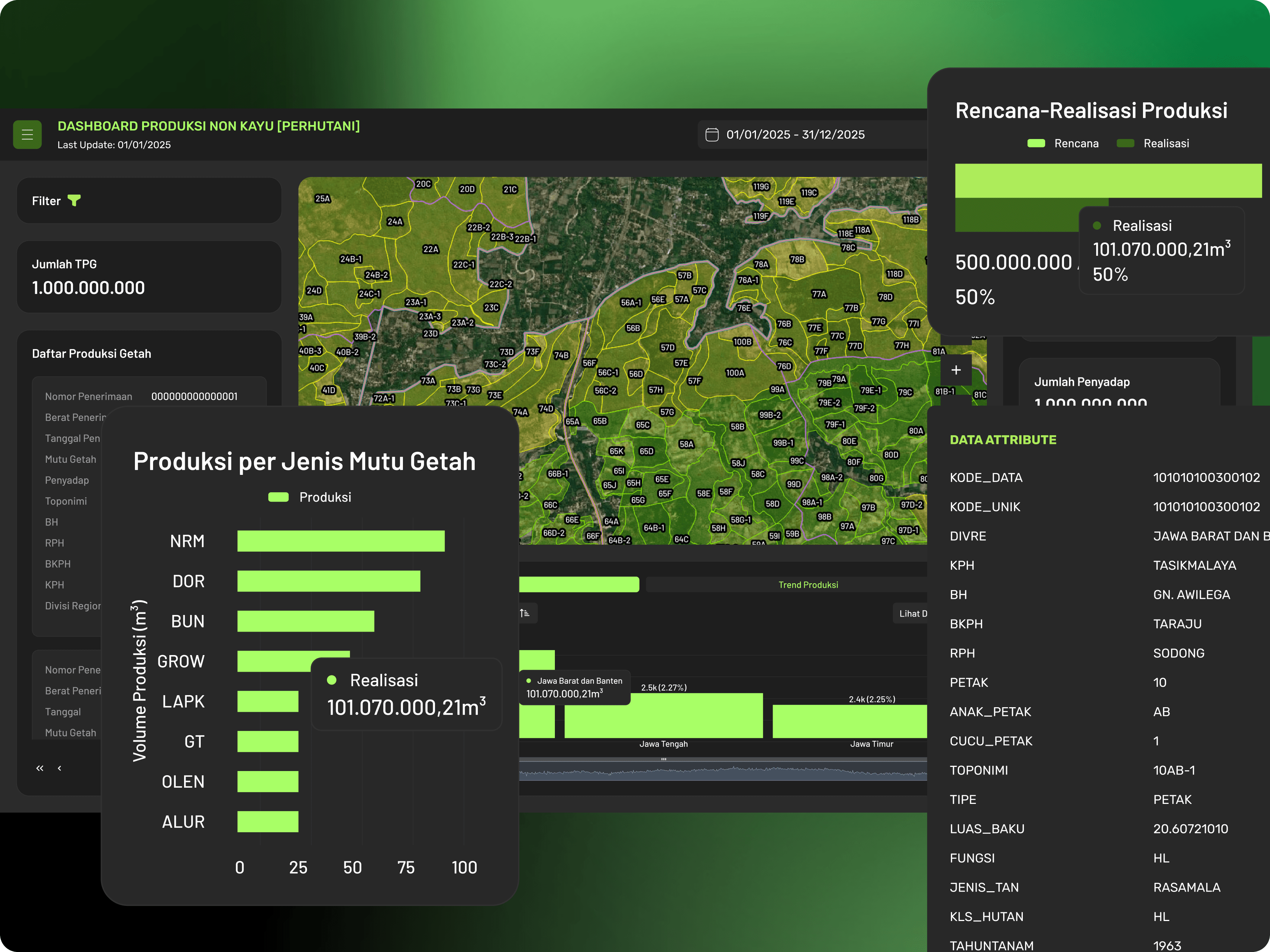
Transform scattered spatial data into structured, trusted, and operational systems.

We helps organizations standardize geospatial workflows, manage data ownership, and build reliable spatial ecosystems across teams and departments.
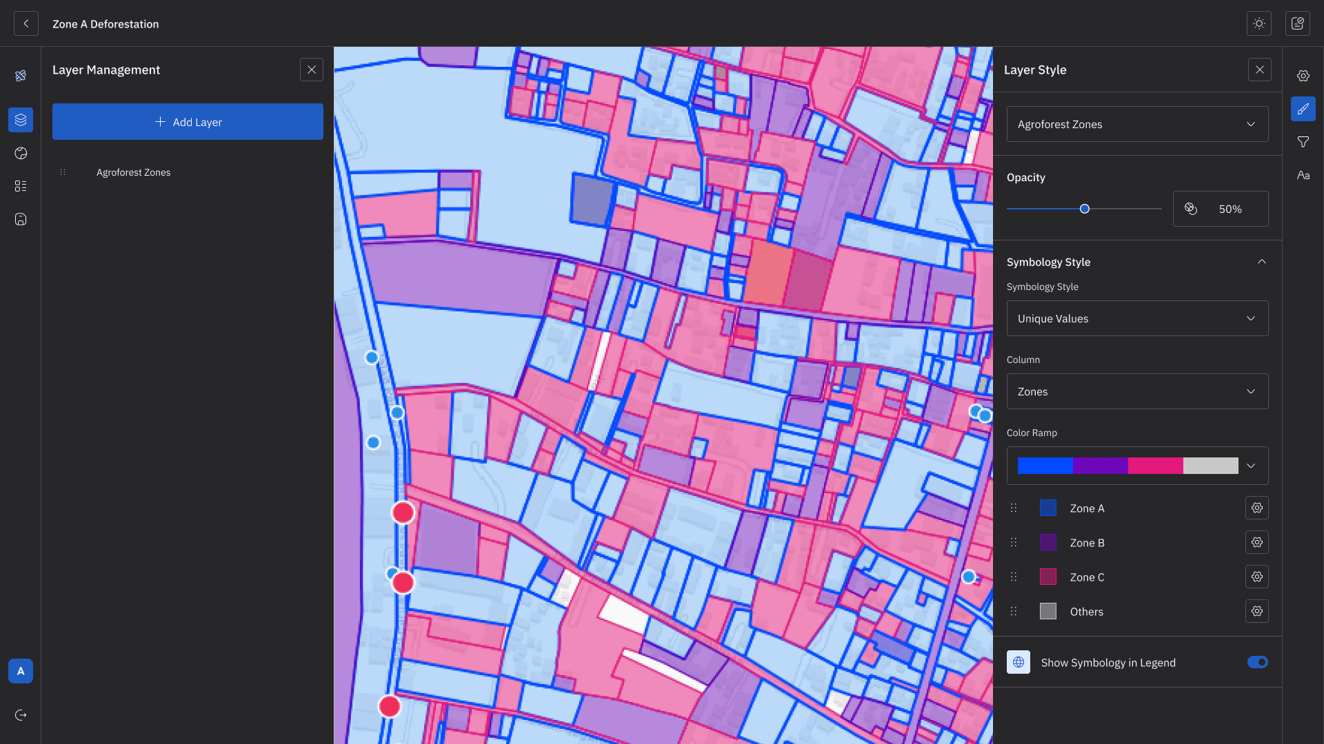
Data Cataloging

From scattered data to a structured catalog

Centralize and organize spatial datasets so you always know what exists.
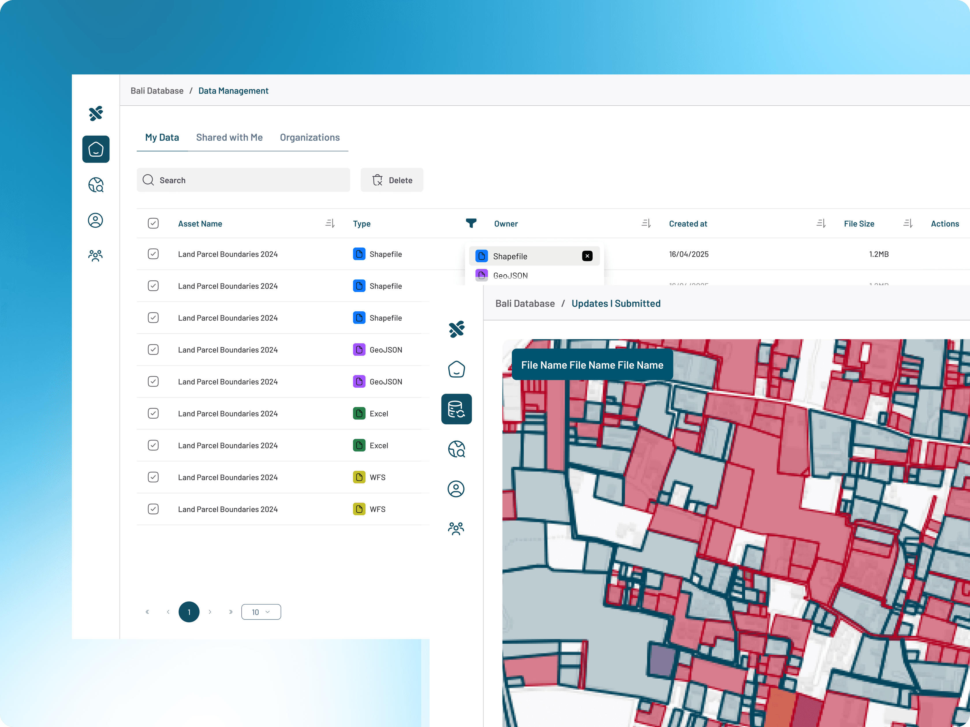
Data Ownership

From unclear roles to defined responsibility

Assign clear ownership to every dataset for better accountability.

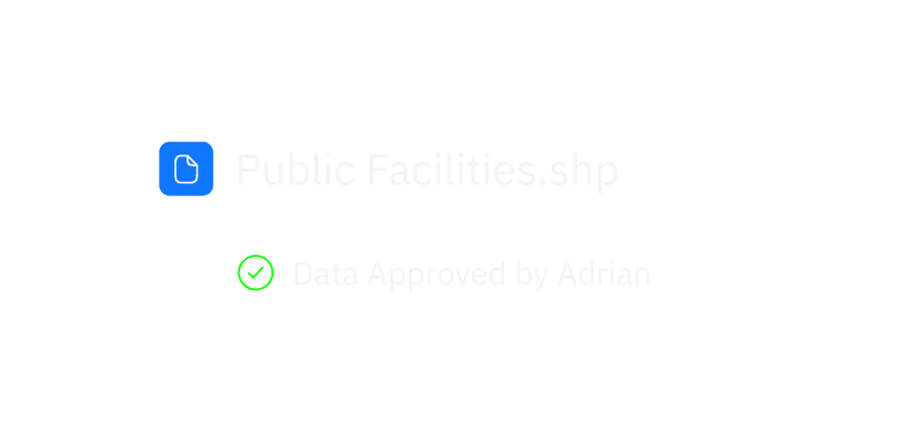
Approval & Validation

From unverified data to trusted datasets

Control data quality through structured approval workflows.

Traceability

From hidden changes to full transparency

Track every update and decision with complete data history.

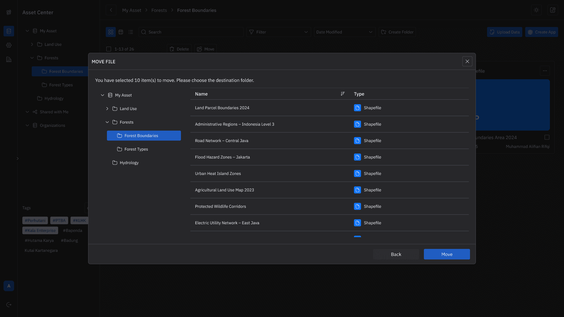
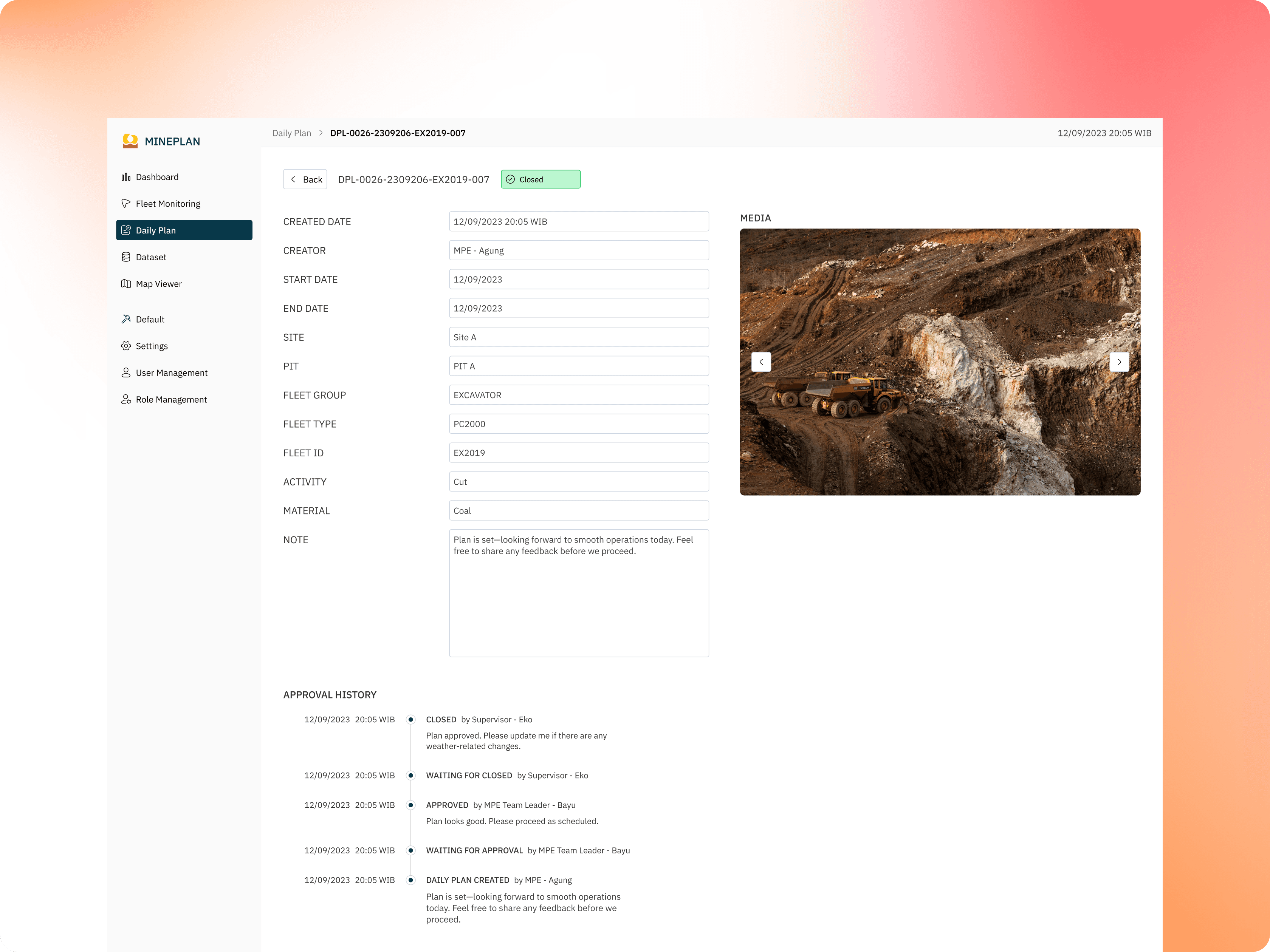
From Data to Decisions—All in One Flow

Your productivity should feel calm, focused, and frictionless.

Organize Your Organization

Manage users, roles, and access across teams with full control.

Organize Your Organization

Manage users, roles, and access across teams with full control.

Manage & Share Your Data

Store, structure, and distribute spatial data in one centralized environment.

Manage & Share Your Data

Store, structure, and distribute spatial data in one centralized environment.

Build Interactive Maps

Turn datasets into clear, visual layers for better understanding.

Build Interactive Maps

Turn datasets into clear, visual layers for better understanding.

Create Dashboards

Transform maps into real-time insights with charts, tables, and indicators.

Create Dashboards

Transform maps into real-time insights with charts, tables, and indicators.

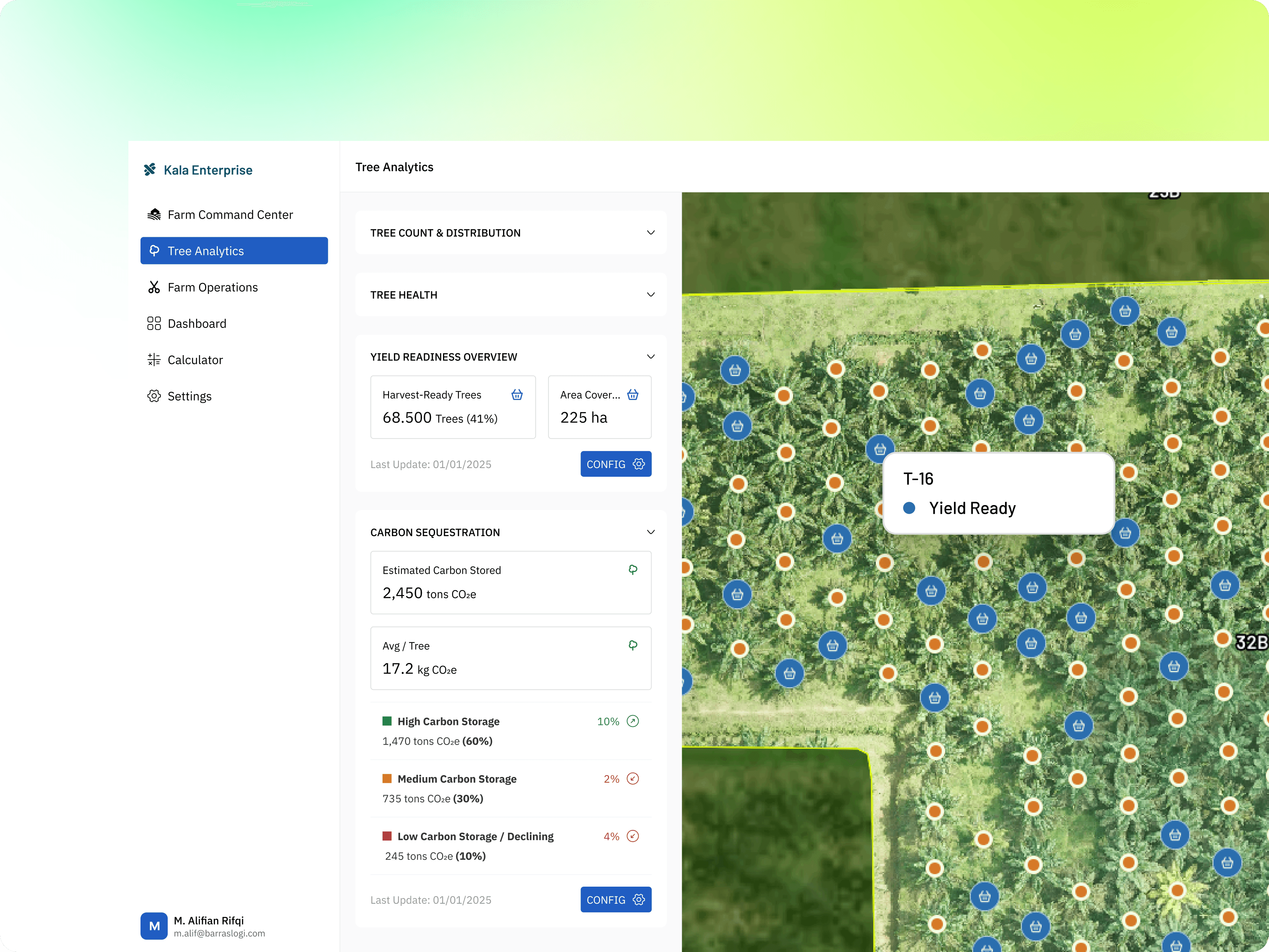
Selected Geospatial Projects Across Sectors

We provide more than just a platform—we deliver the full ecosystem to support your geospatial needs.

Task Prioritization

Focus Mode

Minimal Planner

Unified Workspace

Progress Tracking

Smart Task Prioritization

Cadence analyzes your deadlines, goals, and habits to suggest what matters most — right now.

Ready to Govern Your Geospatial Data?

Standardize workflows, structure your datasets, and build trusted spatial systems with Kala Enterprise.

Task Prioritization

Focus Mode

Minimal Planner

Unified Workspace

Progress Tracking

Smart Task Prioritization

Cadence analyzes your deadlines, goals, and habits to suggest what matters most — right now.