Building a Centralized Spatial Data Governance Platform for Regional Planning
Developing a structured geospatial system to integrate, manage, and standardize spatial data for regional planning and public service decision-making in Badung.
Governance
Spatial Data
WebGIS
Regional Planning

Overview
Badung Regency manages diverse spatial data across multiple government departments, including infrastructure, land use, and social services. The need for a unified and structured geospatial system became critical to support coordinated planning and decision-making across agencies.
Key Challenges
Integrating fragmented regional spatial data into a centralized governance platform for cross-agency coordination and planning.
Spatial data scattered across departments
Government agencies managed spatial data separately without centralized coordination.
Inconsistent data formats and structures
Different departments used varying data standards and categorization methods.
Difficult inter-agency data coordination
Sharing and synchronizing spatial information between agencies was inefficient.
Limited accessibility to trusted spatial data
Limited accessibility to trusted spatial data
What's inside the platform.
Kala Enterprise was implemented as a centralized geospatial platform to unify spatial data, introduce governance structures, and improve data accessibility across government departments for better regional planning.
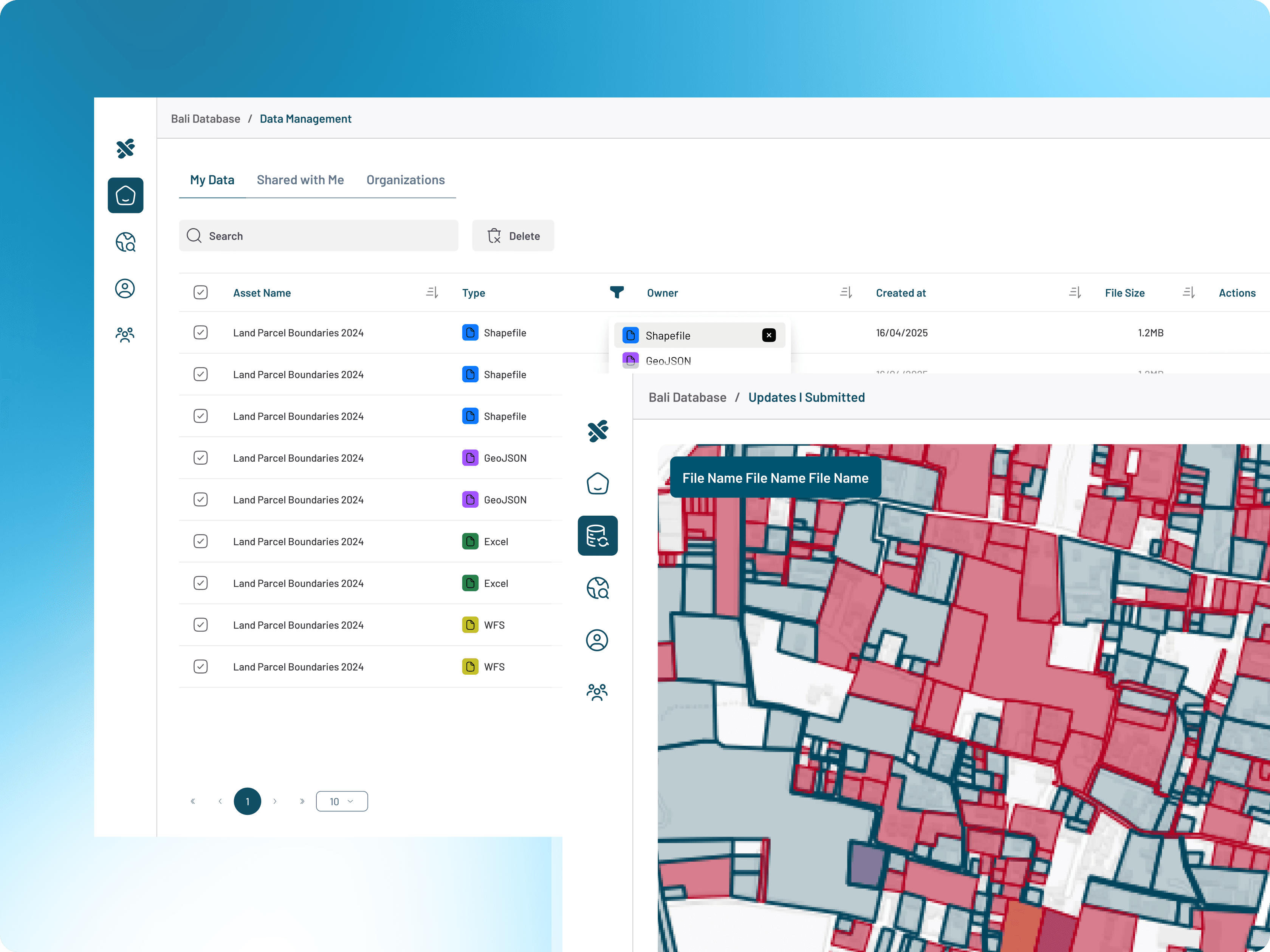
Centralized Spatial Data Hub
Centralize regional spatial information across government agencies and departments.
Inter-Agency Data Integration
Connect and synchronize spatial datasets between multiple government institutions.
Role-Based Access Control
Manage user permissions and data access across organizational structures.
Approval & Validation Workflow
Ensure data quality through structured validation and approval processes.
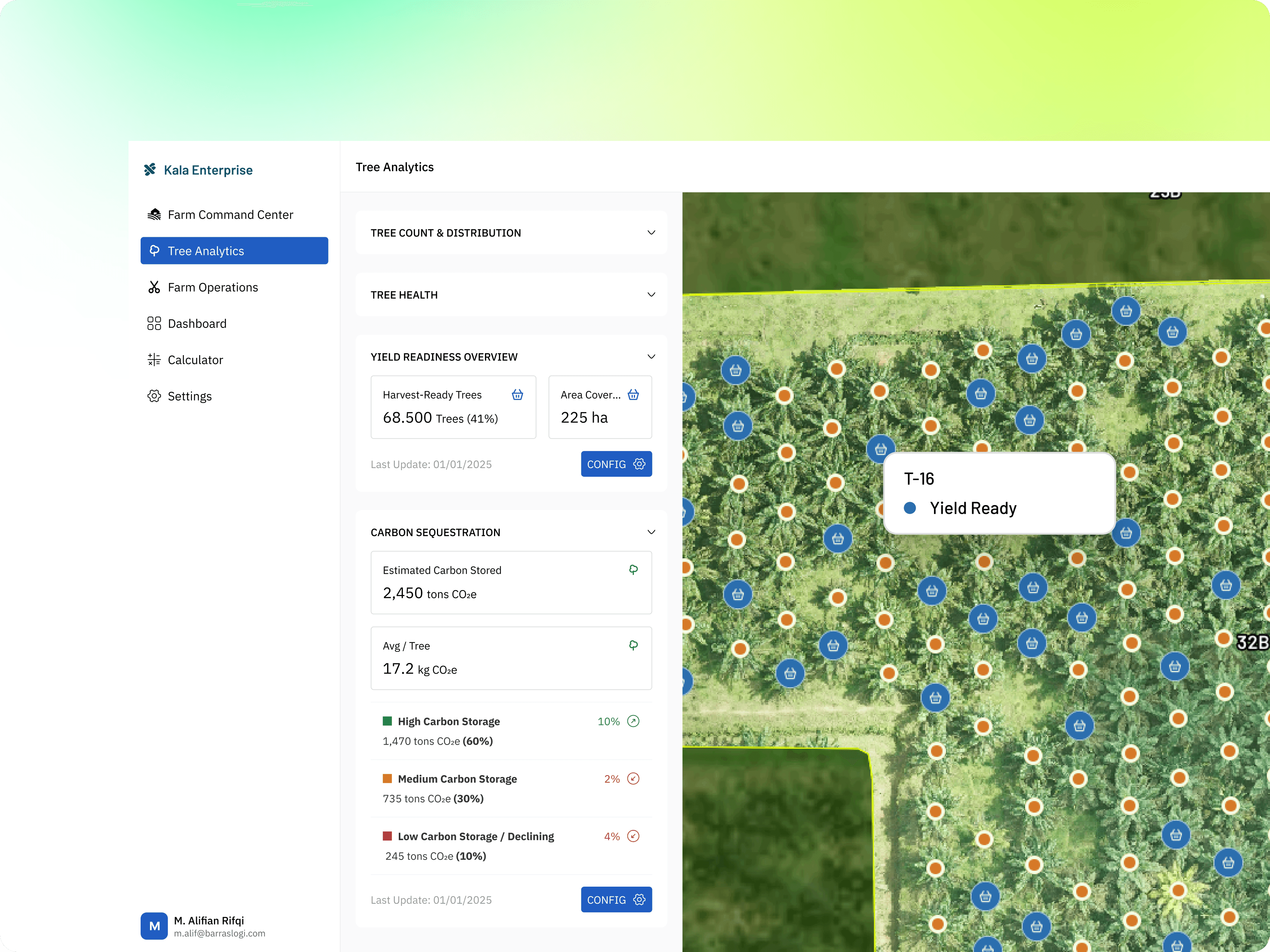
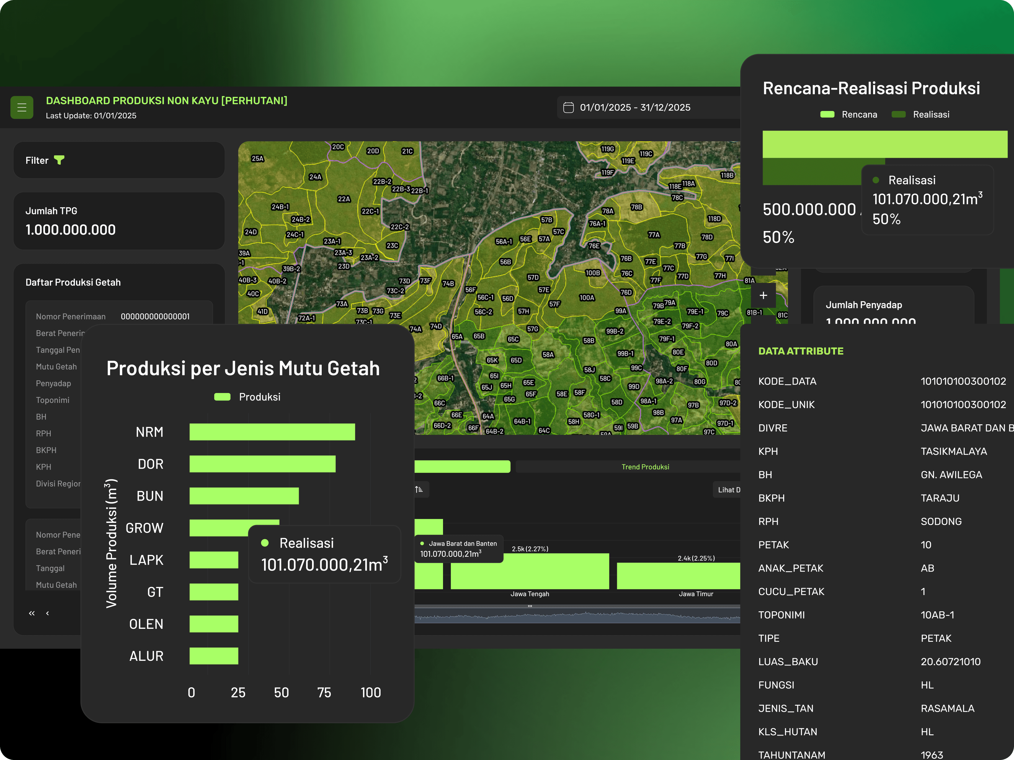
WebGIS Visualization Platform
Visualize regional planning and spatial information through interactive maps.
Regional Planning Dashboard
Support regional planning and policy decisions through centralized monitoring dashboards.
Explore More Case Studies
Supporting government institutions in integrating, standardizing, and managing spatial data to improve planning, coordination, and public service operations.