Standardizing Forest Data Governance with Kala Enterprise
Implementing a structured geospatial system to standardize forest data, governance workflows, and operational consistency across Perhutani units.
WebGIS
Forestry
Data Governance
Spatial Management
Overview
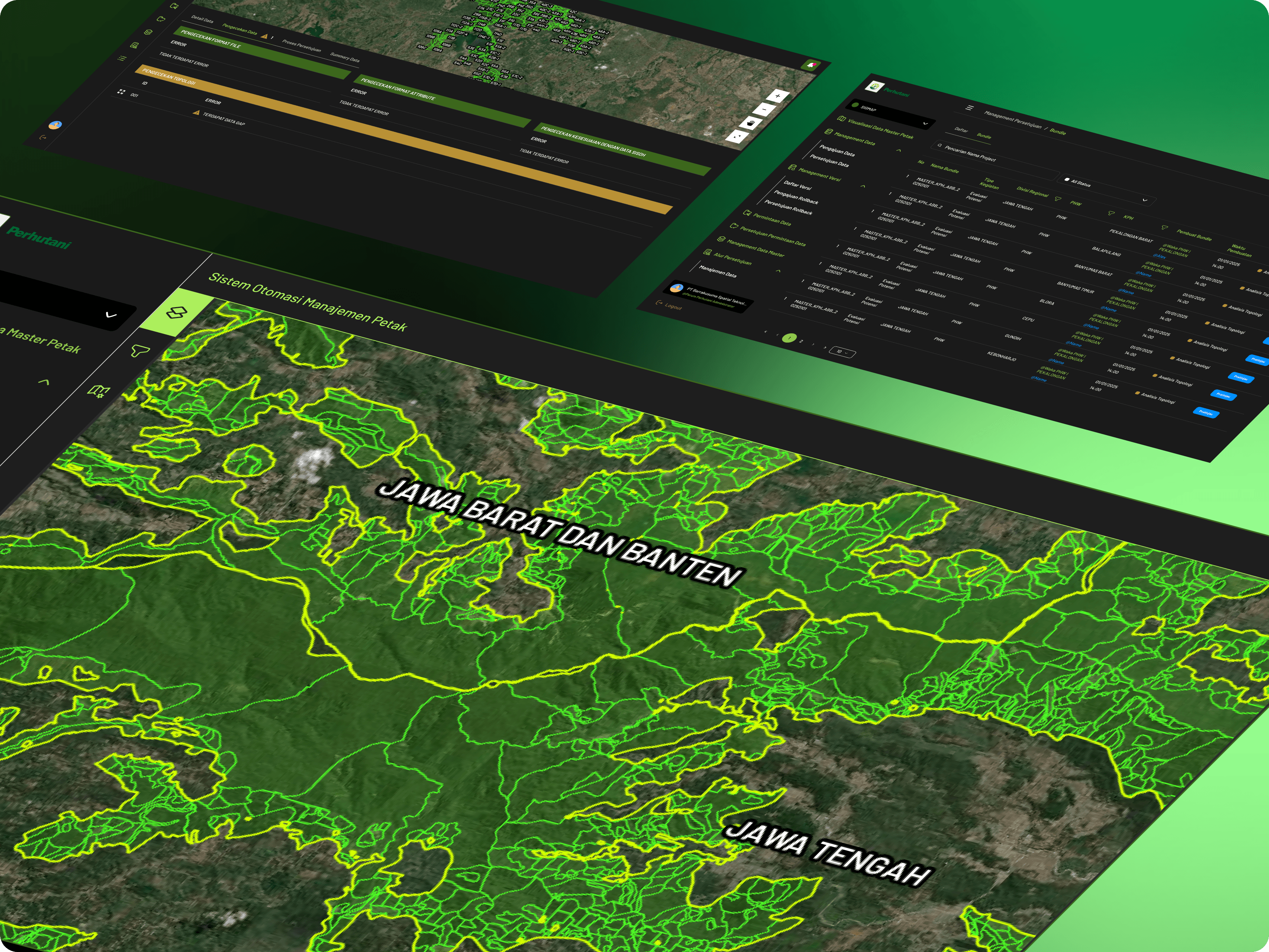
Perum Perhutani manages large-scale forest assets across multiple regions in Indonesia. With distributed operational units, managing spatial data consistency and governance became a critical challenge.
Key Challenges
Fragmented spatial data across operational units
Different operational units managed datasets independently, creating inconsistencies and duplication.
Lack of standardized validation workflow
Validation processes differed between operational levels, reducing trust in data quality.
Unclear ownership and data responsibility
It was difficult to identify who uploaded, updated, or approved critical datasets.
Limited operational visibility for decision-making
Limited operational visibility for decision-making
What's inside the platform.
Kala Enterprise was implemented to standardize spatial data, introduce governance workflows, and centralize forest information across organizational units.
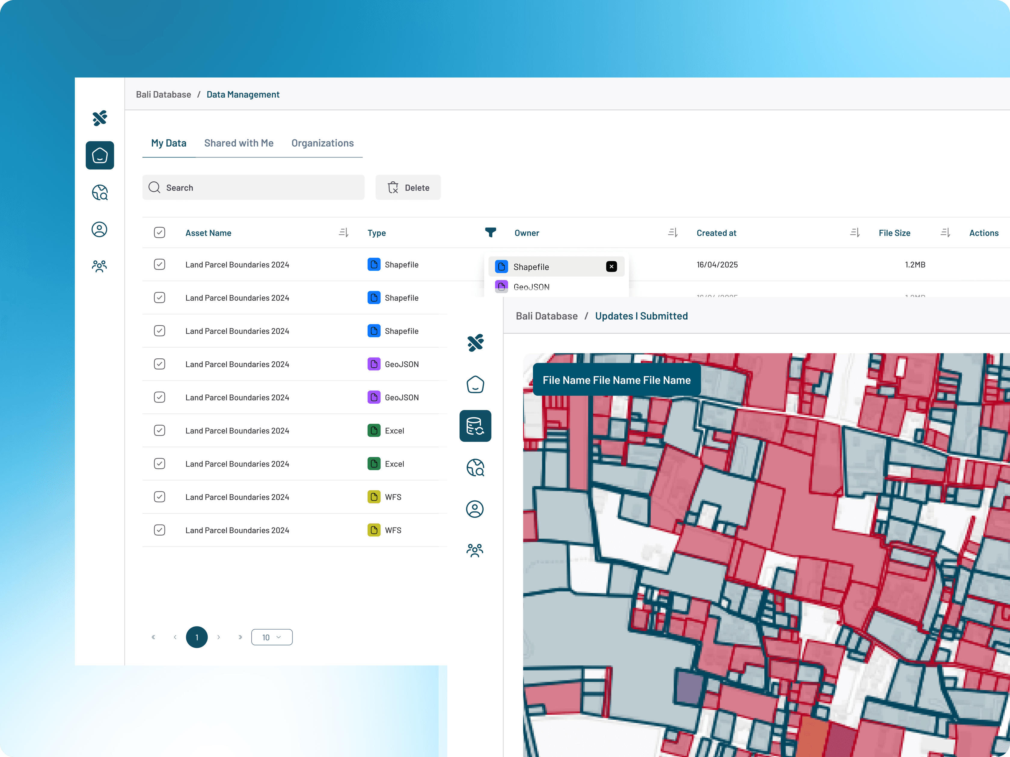
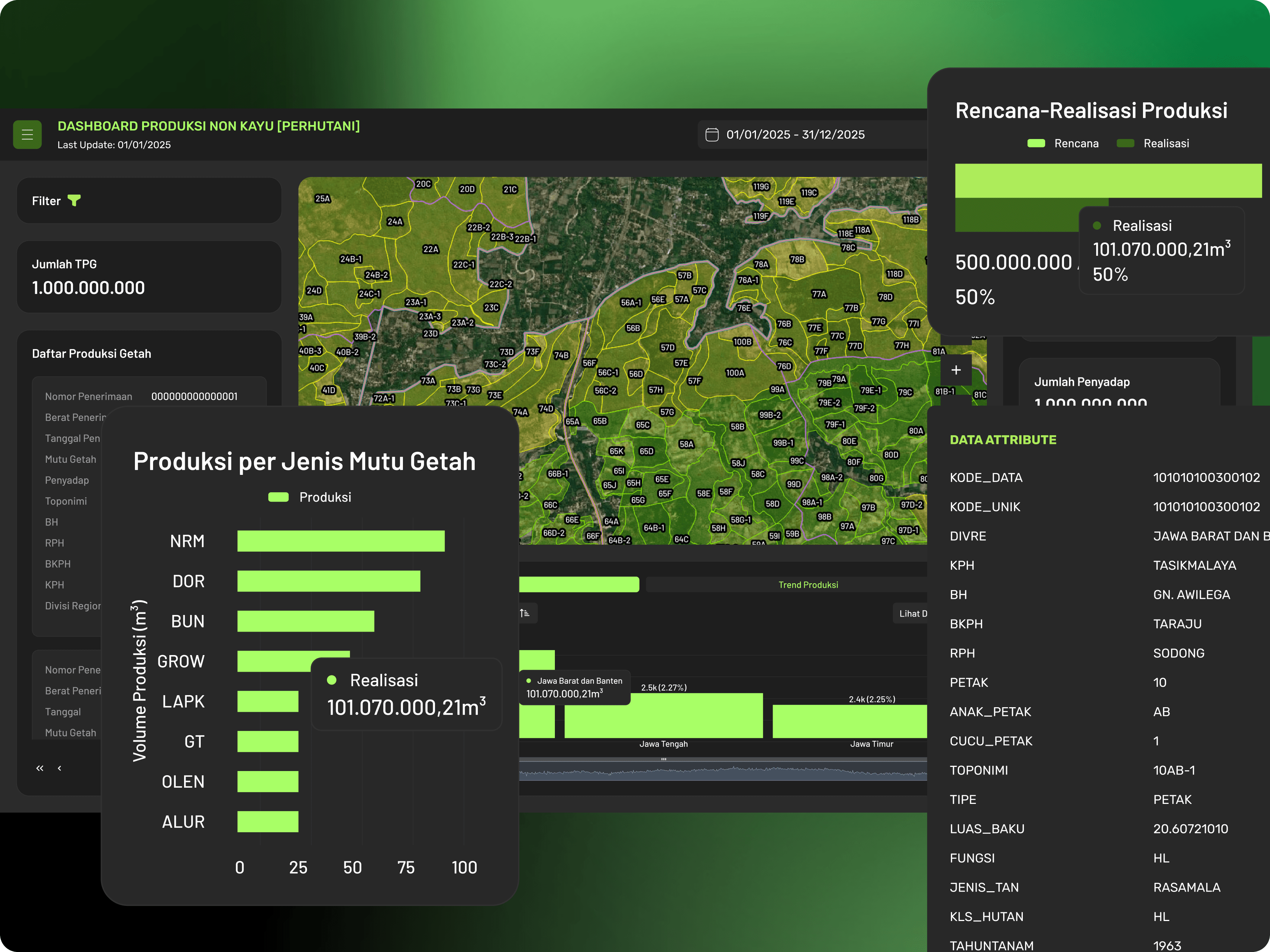
Centralized Spatial Data Management
Organize and manage forestry datasets within one structured spatial environment.
Multi-Level Approval Workflow
Implement hierarchical approval workflows for trusted and validated data management.
User & Role Governance
Define ownership, permissions, and operational responsibilities across teams.
Interactive WebGIS Platform
Access and visualize forestry operational data through web-based mapping systems.
Dashboard & Monitoring System
Monitor forestry operations and reporting through centralized dashboards.
Traceable Data Workflow
Track dataset history, updates, and approvals for transparency and governance.
Explore More Case Studies
Supporting government institutions in integrating, standardizing, and managing spatial data to improve planning, coordination, and public service operations.