Standardize Your Geospatial Operations. Enable Trusted Decisions.
Kala Enterprise is a web-based geospatial platform that enables organizations to manage, analyze, and visualize spatial data with speed, accuracy, and scale.

User & Role Management
Turn raw data into meaningful visual layers.al layers.
✅ Workflow automation & approval systems
✅ Integration with IoT, sensors, or enterprise systems
✅ Add new functionalities to your workflow
✅ Customize views for different users

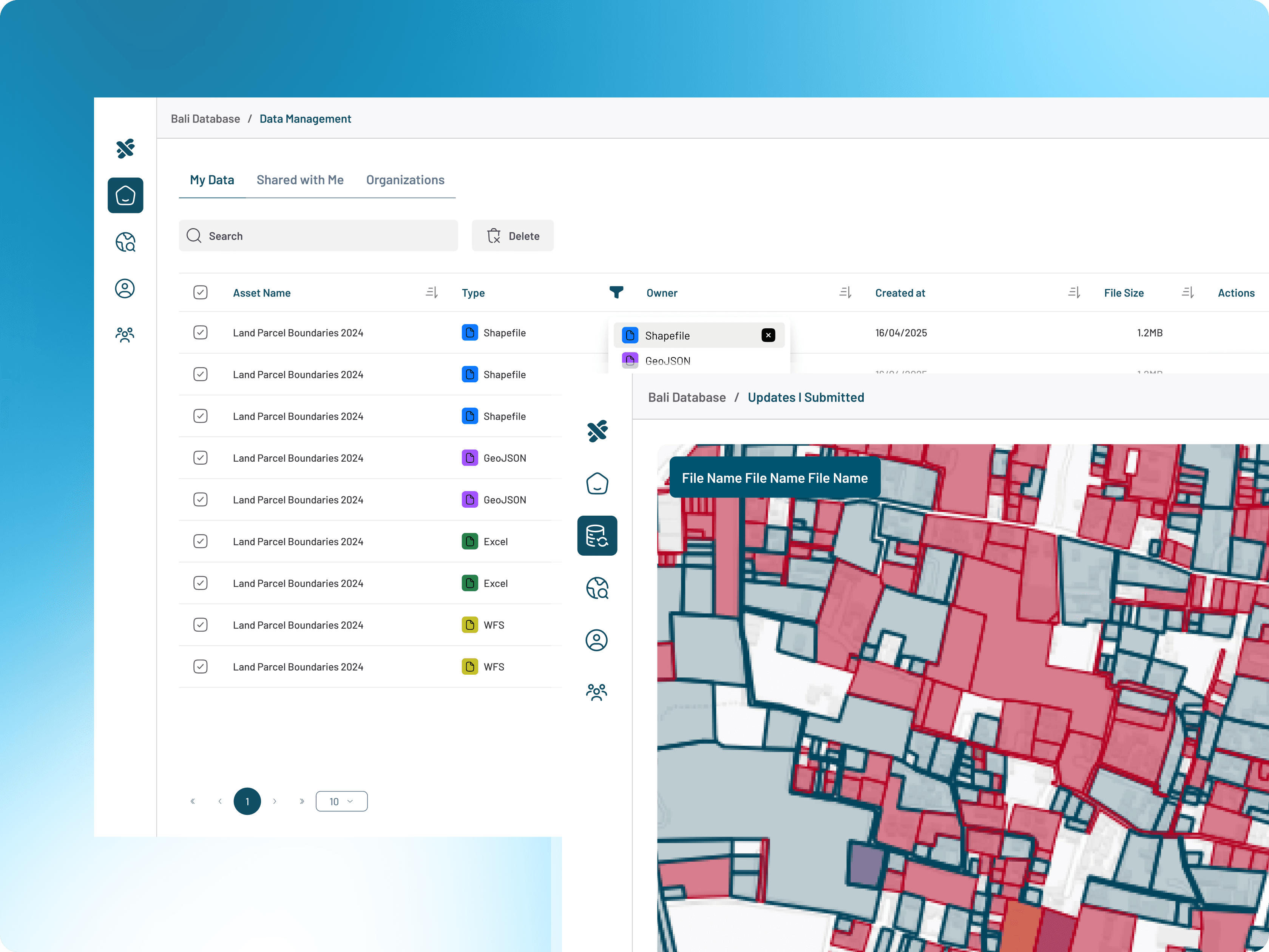
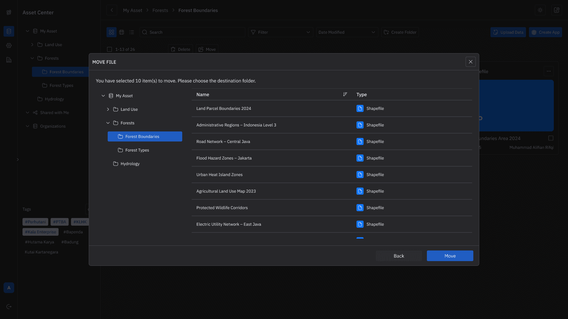
Manage & Share Your Data
Bring all your data into one centralized hub.
✅ Upload SHP, CSV, XLS, WMS/WFS, and more
✅ Organize with folders and structured layers
✅ Share datasets across users or teams
✅ Maintain a single source of truth

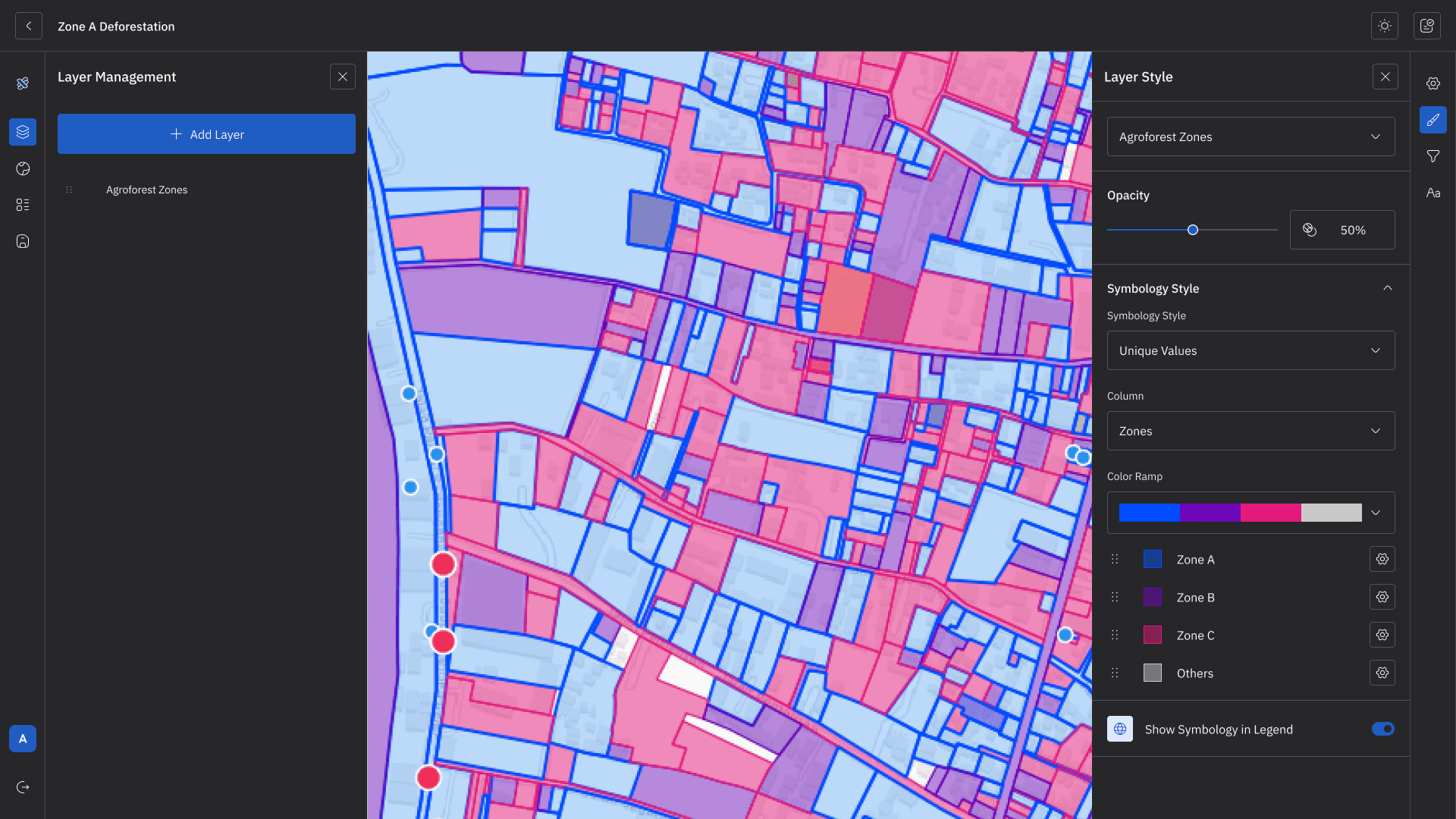
Build Interactive Web Maps
Turn raw data into meaningful visual layers.
✅ Upload SHP, CSV, XLS, WMS/WFS, and more
✅ Organize with folders and structured layers
✅ Share datasets across users or teams
✅ Maintain a single source of truth

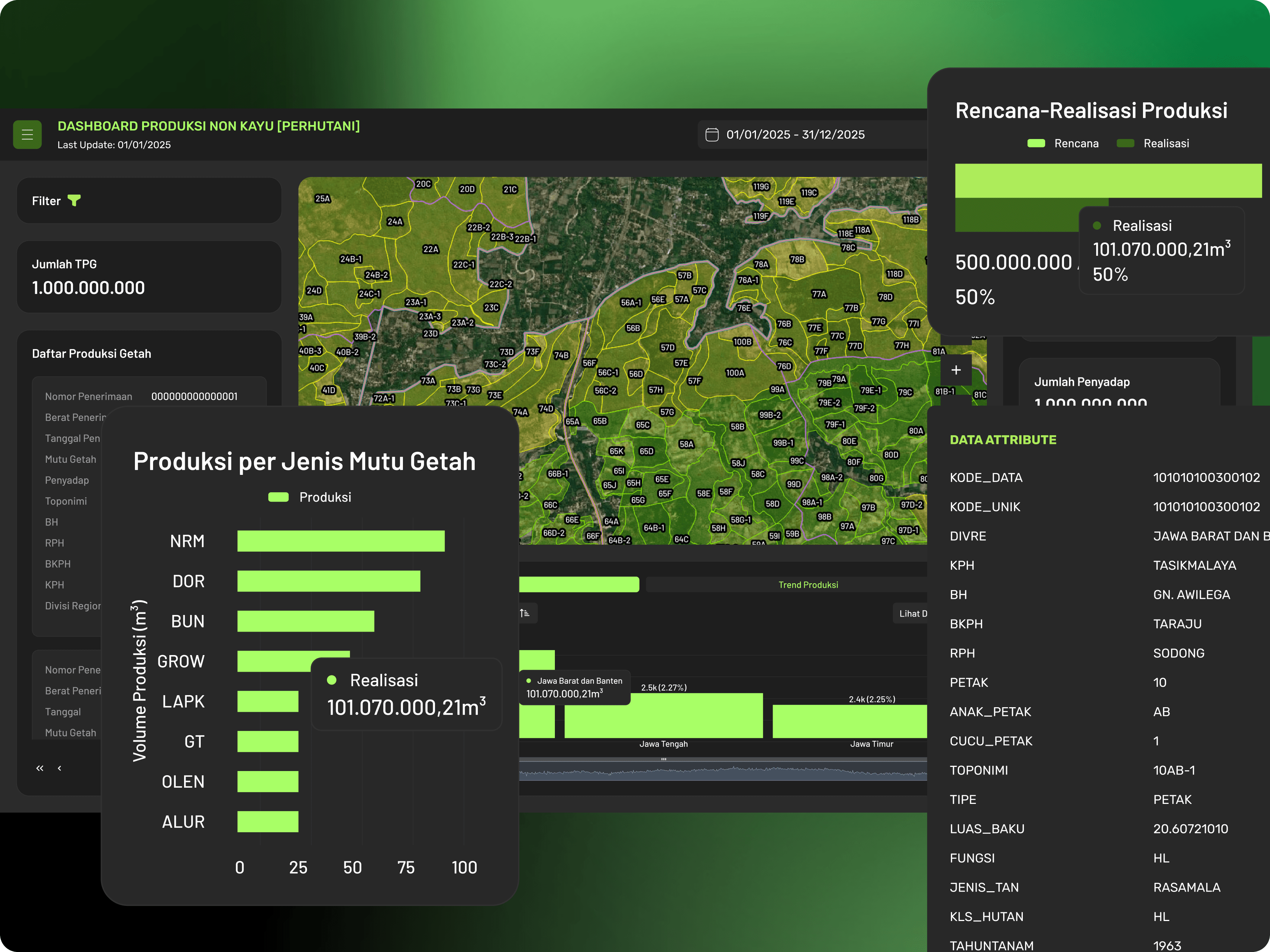
Create Dashboards
Transform maps into decision-making tools.
✅ Connect dashboards directly to your web maps
✅ Add widgets: charts, indicators, tables, details
✅ Monitor key metrics in real time
✅ Customize views for different users
Powered by Kala Geospatial Server
Kala Enterprise is powered by Kala Server—a high-performance geospatial engine designed to handle large-scale data, real-time updates, and seamless visualization across your organization.
Automatic Tiling
Ensures fast loading, smooth navigation, and efficient data delivery—even for massive maps.
Real-Time Publishing
Any updates to your data are automatically published and reflected across maps and dashboards.
High-Speed Rendering
Experience smooth visualization for complex layers, high-resolution imagery, and dense datasets.
Scalable Architecture
From small teams to enterprise-scale deployments, Kala Server handles increasing data and users effortlessly.
Seamless Data Integration
Integrates with WMS/WFS services, external systems, and internal datasets without friction.
Reliable & Secure Delivery
Ensures stable performance, controlled access, and secure distribution of geospatial data.
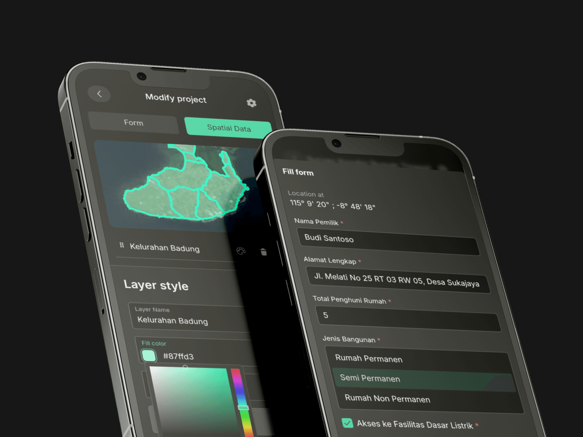
Meet Kala GeoForm
Collecting accurate field data shouldn’t be complicated.
Kala GeoForm is built to make surveys faster, smarter, and fully connected to your geospatial workflows.
Custom Form Builder
Map-Based Data Capture
Offline & Collaborative
Easy to Export
Applied Across Industries. Designed to Solve Data Governance Challenges.
We’ve implemented it across multiple sectors, solving real challenges in how data is managed, validated, and used for decision-making.
Centralized Spatial Data for Better Regional Decision-Making
Supporting government institutions in integrating, standardizing, and managing spatial data to improve planning, coordination, and public service operations.
Read More
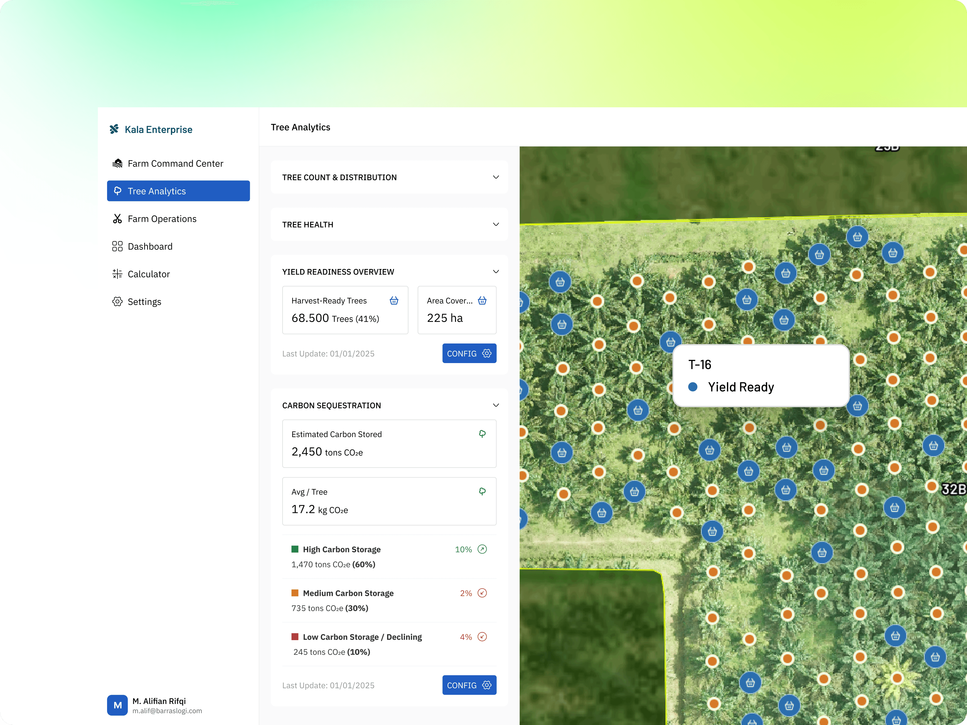
Spatial Intelligence for Plantation Management
Enabling plantation operations with structured spatial data, predictive analytics, monitoring systems, and data-driven operational insights.
Read More
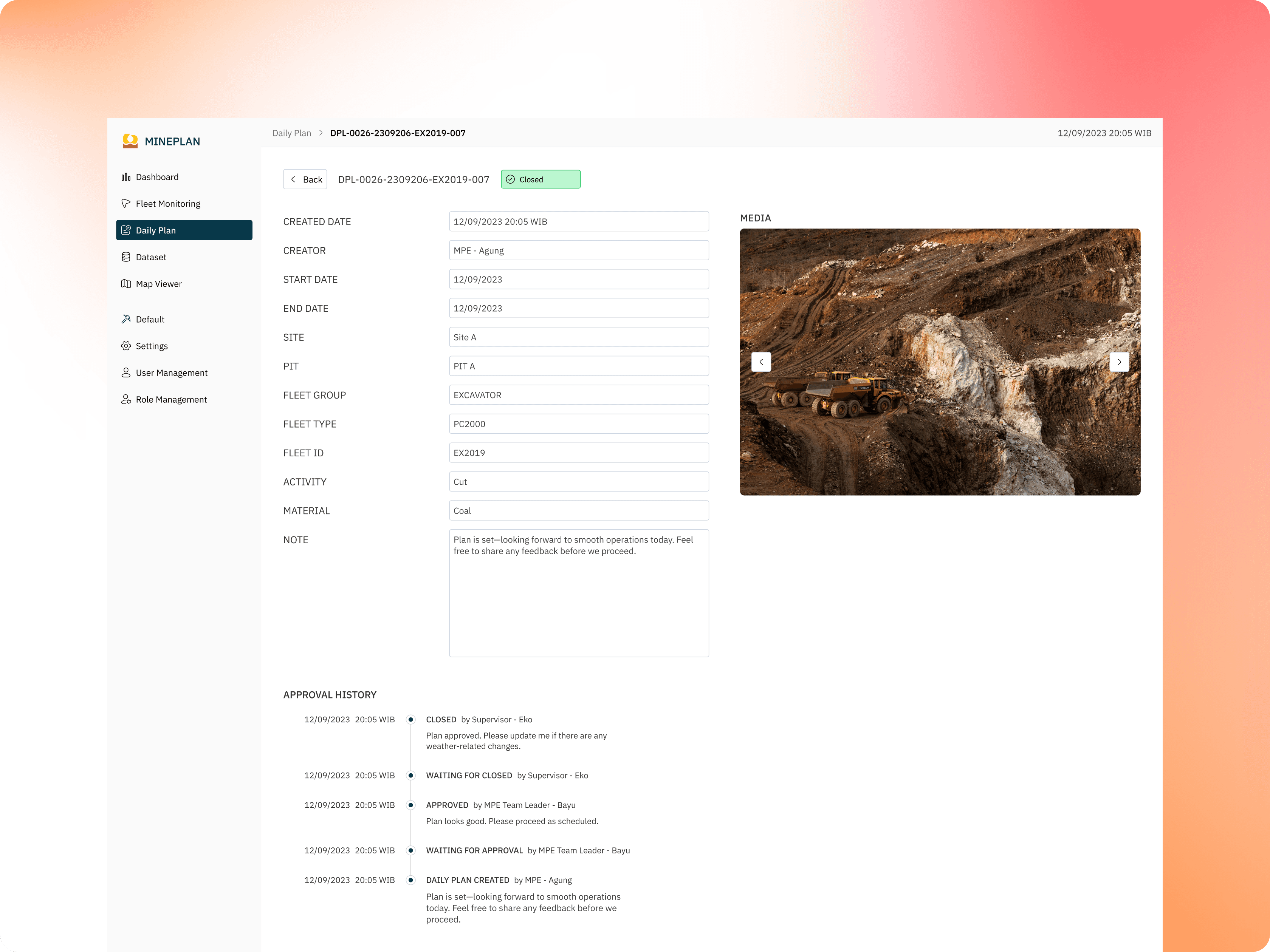
Integrated Geospatial Systems for Mining Operations
Helping mining companies centralize operational data, improve monitoring, and enhance visibility through connected geospatial workflows and real-time systems.
Read More
Geospatial Governance for Forestry Operations
Supporting forestry organizations in managing forest assets, land distribution, and operational workflows through structured and standardized geospatial systems.
Read More
Ready to Govern Your Geospatial Data?
Standardize workflows, structure your datasets, and build trusted spatial systems with Kala Enterprise.
Frequently Asked Questions
Find everything you need to know about Cadence.
What is Kala Enterprise?
Kala Enterprise is a geospatial data governance platform designed to help organizations structure, manage, standardize, and utilize spatial data within one connected system.
Who is Kala Enterprise built for?
What problems does Kala Enterprise solve?
Can Kala Enterprise manage both spatial and non-spatial data?
What data formats are supported?
Can we build dashboards and WebGIS applications using Kala Enterprise?
Does Kala Enterprise support user roles and access control?
Is Kala Enterprise suitable for multi-department or multi-agency collaboration?