Enabling Data-Driven Plantation Management with Kala Enterprise
Plantation operations involve large-scale land management, crop monitoring, and yield optimization across diverse geographic areas. To improve decision-making, organizations require structured spatial data combined with analytical capabilities.
Plantation
Spatial Analytics
Dashboard
Predictive Analysis
Overview
Plantation operations involve large-scale land management, crop monitoring, and yield optimization across diverse geographic areas. To improve decision-making, organizations require structured spatial data combined with analytical capabilities.
Key Challenges
Building scalable plantation analytics and spatial monitoring workflows to support proactive operational decision-making.
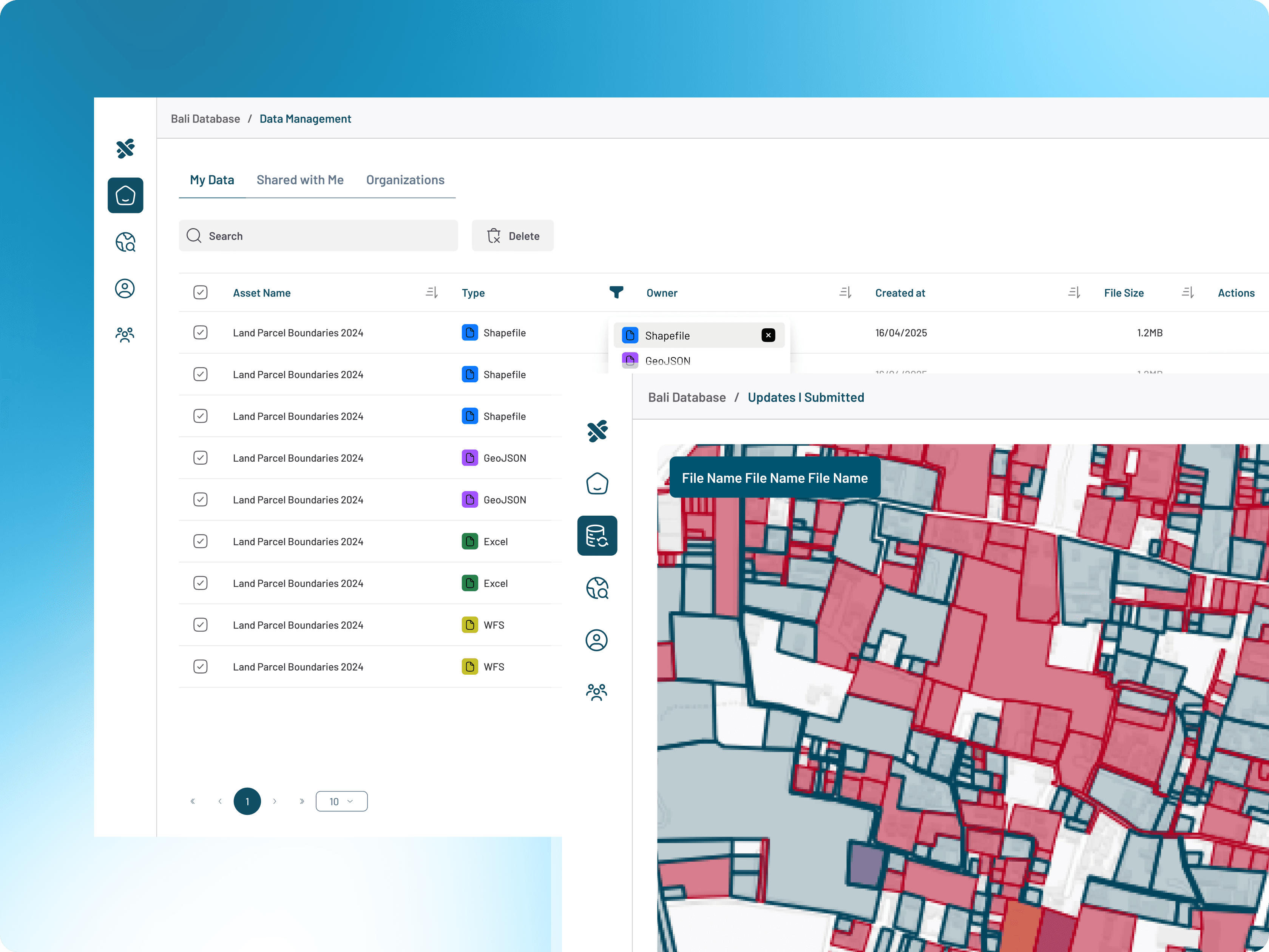
Scattered plantation operational data
Plantation information existed across disconnected systems and formats.
Lack of structured analytical workflows
Analytical processes were manual and difficult to scale operationally.
Difficulty monitoring plantation performance spatially
Teams lacked visibility into plantation conditions and operational performance geographically.
Manual and reactive operational decisions
Manual and reactive operational decisions
What's inside the platform.
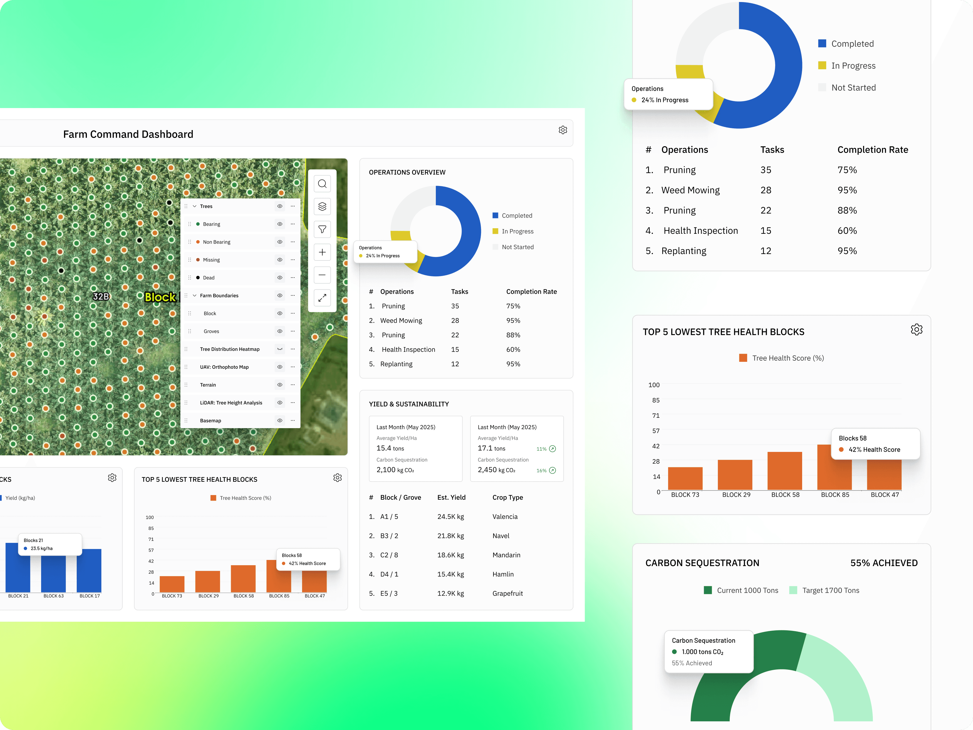
Kala Enterprise was implemented to standardize plantation data, integrate spatial datasets, and enable analytical workflows such as predictive modeling, correlation analysis, and crop scoring systems.
Plantation Data Management
Manage plantation operational and spatial datasets within one platform.
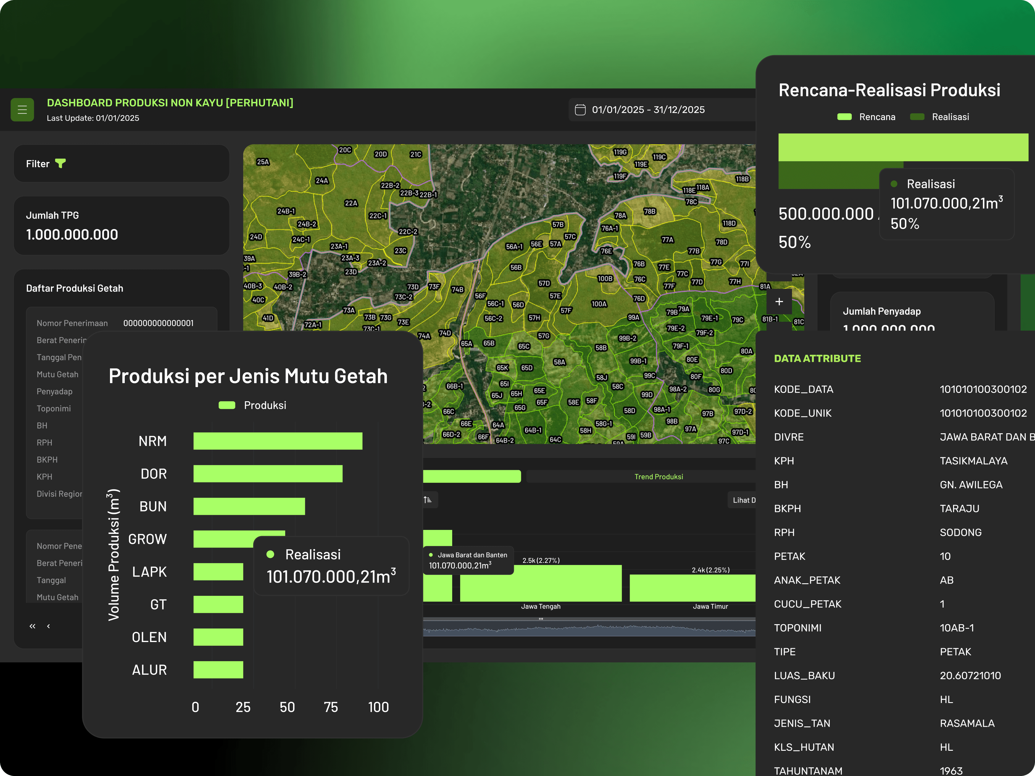
Predictive Analytics Models
Analyze plantation variables using regression and classification models.
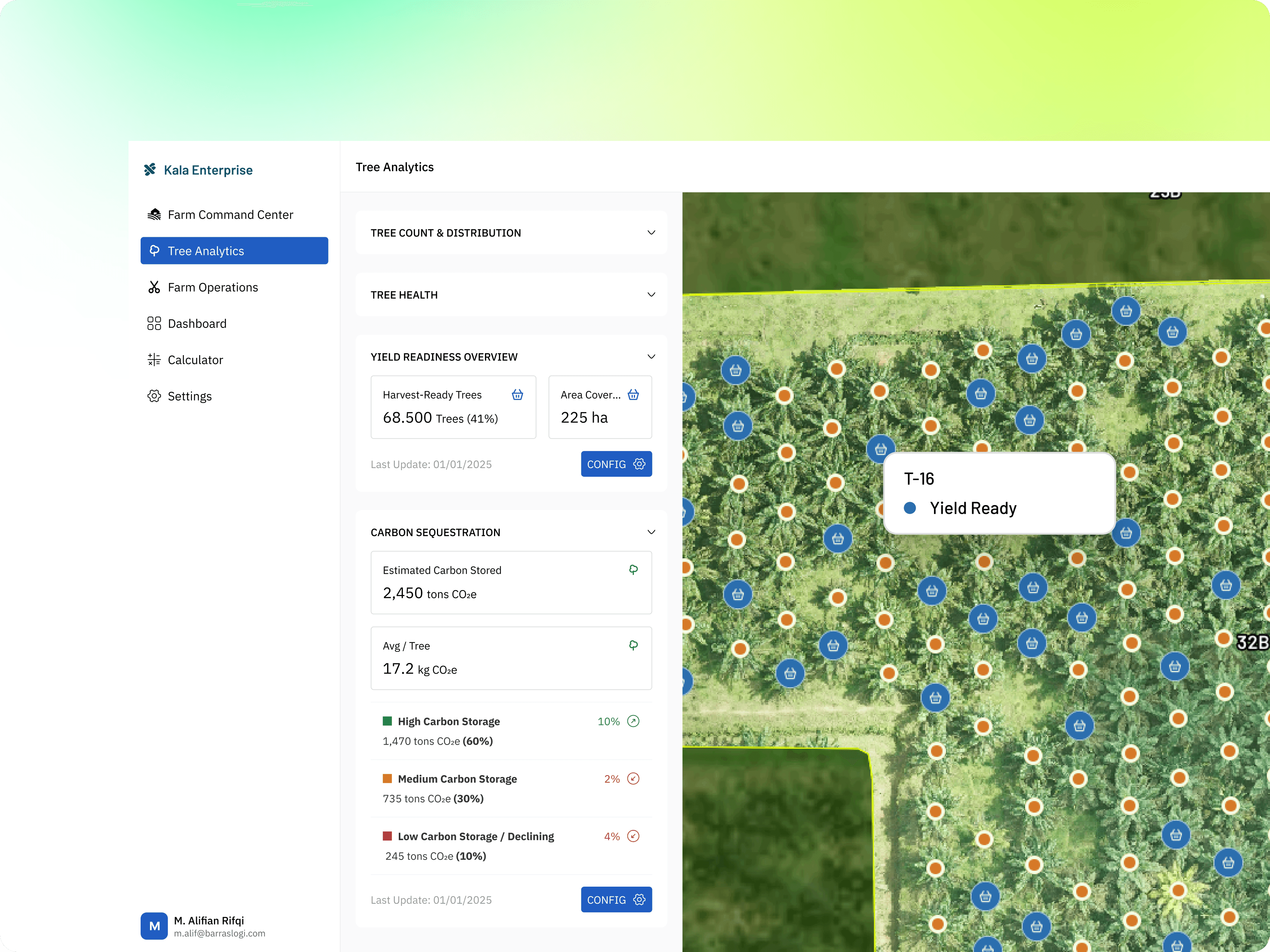
Crop Monitoring System
Monitor plantation conditions and performance spatially through interactive systems.
Operational Dashboard
Visualize operational insights and plantation analytics through dashboards.
Correlation & Scoring Analysis
Identify operational relationships and scoring indicators for plantation optimization.
Spatial Intelligence Workflow
Enable spatial-based analytical workflows for operational decision support.
Explore More Case Studies
Supporting government institutions in integrating, standardizing, and managing spatial data to improve planning, coordination, and public service operations.